
Mieroszyno | |
|---|---|
Village | |
 Czarna Woda River in Mieroszyno | |
 Mieroszyno | |
| Coordinates: 54°48′0″N 18°18′47″E / 54.80000°N 18.31306°E | |
| Country | |
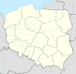
| Voivodeship | Pomeranian |
| County | Puck |
| Gmina | Puck |
| Population | 601 |
| Time zone | UTC+1 (CET) |
| • Summer (DST) | UTC+2 (CEST) |
| Vehicle registration | GPU |
Mieroszyno [mjɛrɔˈʂɨnɔ] is a village in the administrative district of Gmina Puck, within Puck County, Pomeranian Voivodeship, in northern Poland.[1] It lies approximately 13 kilometres (8 mi) north-west of Puck and 53 km (33 mi) north-west of the regional capital Gdańsk. It is located within the ethnocultural region of Kashubia in the historic region of Pomerania.
YouTube Encyclopedic
-
1/3Views:1 1271 1481 865
-
Nowy kurs w Szkole Jazdy Kursant (pakiet do kat.B) Wrocław
-
pokoje gościnne Mieroszyno
-
Chłapowo, Mieroszyno, Tupadły, Jastrzębia Góra, Rozewie, Władysławowo - lot widokowy
Transcription
History
Mieroszyno was a royal village of the Polish Crown, administratively located in the Puck County in the Pomeranian Voivodeship.[2]
During the German occupation of Poland (World War II), in 1942, several Polish families were expelled by the Germans, and enslaved as forced labour in the county.[3]
References
- ^ "Central Statistical Office (GUS) - TERYT (National Register of Territorial Land Apportionment Journal)" (in Polish). 2008-06-01.
- ^ Biskup, Marian; Tomczak, Andrzej (1955). Mapy województwa pomorskiego w drugiej połowie XVI w. (in Polish). Toruń. p. 100.
{{cite book}}: CS1 maint: location missing publisher (link) - ^ Wardzyńska, Maria (2017). Wysiedlenia ludności polskiej z okupowanych ziem polskich włączonych do III Rzeszy w latach 1939-1945 (in Polish). Warsaw: IPN. p. 119. ISBN 978-83-8098-174-4.

This Puck County location article is a stub. You can help Wikipedia by expanding it. |