
Trocy-en-Multien | |
|---|---|
 The church in Trocy-en-Multien | |
Location of Trocy-en-Multien  | |
 Trocy-en-Multien 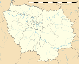 Trocy-en-Multien | |
| Coordinates: 49°02′32″N 2°57′44″E / 49.0421°N 2.9622°E | |
| Country | France |
| Region | Île-de-France |
| Department | Seine-et-Marne |
| Arrondissement | Meaux |
| Canton | La Ferté-sous-Jouarre |
| Intercommunality | Pays de l'Ourcq |
| Government | |
| • Mayor (2020–2026) | Arnaud Rousseau[1] |
| Area 1 | 7.46 km2 (2.88 sq mi) |
| Population (Jan. 2021)[2] | 228 |
| • Density | 31/km2 (79/sq mi) |
| Time zone | UTC+01:00 (CET) |
| • Summer (DST) | UTC+02:00 (CEST) |
| INSEE/Postal code | 77476 /77440 |
| Elevation | 65–141 m (213–463 ft) |
| 1 French Land Register data, which excludes lakes, ponds, glaciers > 1 km2 (0.386 sq mi or 247 acres) and river estuaries. | |
Trocy-en-Multien (French pronunciation: [tʁɔsi ɑ̃ myltjɛ̃] ⓘ) is a commune in the Seine-et-Marne department in the Île-de-France region in north-central France.
YouTube Encyclopedic
-
1/1Views:957
-
Attitude Country Etrepilly - Master Teams 2011
Transcription
Demographics
Inhabitants of Trocy-en-Multien are called Trocéens.
See also
References
- ^ "Répertoire national des élus: les maires" (in French). data.gouv.fr, Plateforme ouverte des données publiques françaises. 13 September 2022.
- ^ "Populations légales 2021". The National Institute of Statistics and Economic Studies. 28 December 2023.
External links
Wikimedia Commons has media related to Trocy-en-Multien.
- 1999 Land Use, from IAURIF (Institute for Urban Planning and Development of the Paris-Île-de-France région) (in English)
This article related to a Seine-et-Marne location is a stub. You can help Wikipedia by expanding it. |