
Your web browser is no longer supported. To improve your experience update it here
Australian weather forecast
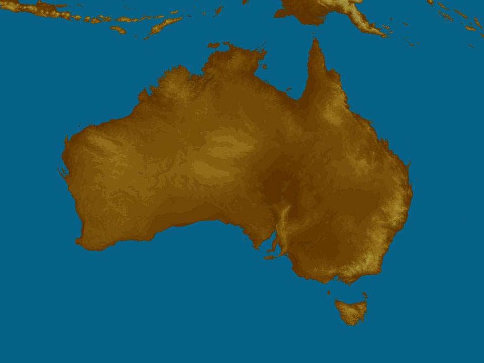
National weather
Rain Radar map
14:00 AEST14:05 AEST14:10 AEST14:15 AEST14:20 AEST14:25 AEST14:30 AEST
Weather Satellite
13:20 AEST13:30 AEST13:40 AEST13:50 AEST14:00 AEST14:10 AEST14:20 AEST


Synoptic weather chart
View national synoptic
Thursday 01:05 EST
Showers & storms, possibly heavy, over inland NSW in increasingly unstable air. Showers over the NT's eastern Top End & north QLD in moist easterly winds. Showers & storms over southwest WA with an offshore low. Coastal showers for QLD, NSW & Vic in onshore winds around a high.
Issued Wednesday 03:05 EST
Weather warnings
Moderate Flood Warning For The Warrego River (Nsw)
Australian Government Bureau of Meteorology, New South Wales Moderate Flood Warning For The Warrego River (Nsw) Issued at 12:40 PM EST on Wednesday 01 May 2024 Flood Warning Number: 17 MODERATE FLOODING OCCURRING AT FORDS BRIDGE BYWASH, WITH A MODERATE FLOOD PEAK NEAR 2.50 M LIKELY LATE WEDNESDAY Moderate flooding is currently occurring at Fords Bridge Bywash. A moderate flood peak near 2.50 m is likely late Wednesday. Warrego River (NSW): Moderate flooding is occurring along the Warrego River (NSW) at Fords Bridge Bywash. The Warrego River at Fords Bridge Bywash is currently at 2.45 metres and steady, above the moderate flood level (2.30 m). The Warrego River at Fords Bridge Bywash is likely to peak near 2.50 metres late Wednesday with moderate flooding. Warrego River at Enngonia: Cancellation Flood Safety Advice: In life threatening emergencies, call 000 (triple zero) immediately. If you require rescue, assistance to evacuate or other emergency help, ring NSW SES on 132 500. * Avoid drowning. Stay out of rising water, seek refuge in the highest available place. * Prevent damage to your vehicle. Move it under cover, away from areas likely to flood. * Avoid being swept away. Stay out of fast-flowing creeks and storm drains. * Never drive, ride or walk through flood water. Flood water can be deceptive and dangerous.} For more emergency information, advice, and access to the latest river heights and rainfall observations and forecasts: * NSW SES: www.ses.nsw.gov.au * RMS Live Traffic: www.livetraffic.com * Latest River Heights and Rainfall Observations: www.bom.gov.au/nsw/flood/outerwest.shtml * Latest NSW Warnings: www.bom.gov.au/nsw/warnings/ * Rainfall Forecasts: www.bom.gov.au/australia/meteye/ * BOM NSW Twitter: www.twitter.com/BOM_NSW Next issue: The next warning will be issued by 01:00 pm EST on Friday 03 May 2024. Latest River Heights: Warrego River at Barringun No. 2,1.76,Steady,12:00 PM WED 01/05/24 Warrego River at Fords Bridge Bywash,2.45,Steady,12:00 PM WED 01/05/24 This advice is also available by dialling 1300 659 210. Warning, rainfall and river information are available at www.bom.gov.au/nsw/flood. The latest weather forecast is available at www.bom.gov.au/nsw/forecasts.Strong Wind Warning for Pilbara Coast East & Leeuwin, Albany and Esperance coasts. Cancellation for Bunbury Geographe Coast
Australian Government Bureau of Meteorology Western Australia Marine Wind Warning Summary for Western Australia Issued at 10:11 AM WST on Wednesday 01 May 2024 for the period until midnight WST Thursday 02 May 2024 Wind Warnings for Wednesday 01 May Strong Wind Warning for the following areas: Pilbara Coast East, Leeuwin Coast, Albany Coast and Esperance Coast Cancellation for the following areas: Bunbury Geographe Coast Wind Warnings for Thursday 02 May Strong Wind Warning for the following areas: Albany Coast and Esperance Coast The next marine wind warning summary will be issued by 4:00 pm WST Wednesday. ================================================================================ Check the latest Coastal Waters Forecast or Local Waters Forecast at http://www.bom.gov.au/wa/forecasts/map.shtml for information on wind, wave and weather conditions for these coastal zones. ================================================================================Strong Wind Warning for Sunshine Coast Waters, Moreton Bay, Gold Coast Waters & Peninsula, Cooktown, Cairns, Townsville and K'gari coasts
Australian Government Bureau of Meteorology Queensland Marine Wind Warning Summary for Queensland Issued at 12:11 PM EST on Wednesday 01 May 2024 for the period until midnight EST Thursday 02 May 2024 Wind Warnings for Wednesday 01 May Strong Wind Warning for the following areas: Peninsula Coast, Cooktown Coast, Cairns Coast, Townsville Coast, K'gari Coast, Sunshine Coast Waters, Moreton Bay and Gold Coast Waters Wind Warnings for Thursday 02 May Strong Wind Warning for the following areas: Torres Strait, Peninsula Coast, Cooktown Coast, Cairns Coast, Townsville Coast, Capricornia Coast, K'gari Coast, Sunshine Coast Waters and Gold Coast Waters The next marine wind warning summary will be issued by 3:50 pm EST Wednesday. ================================================================================ Check the latest Coastal Waters Forecast or Local Waters Forecast at http://www.bom.gov.au/qld/forecasts/map.shtml for information on wind, wave and weather conditions for these coastal zones. ================================================================================Strong Wind Warning for Byron and Coffs coasts
Australian Government Bureau of Meteorology New South Wales Marine Wind Warning Summary for New South Wales Issued at 12:11 PM EST on Wednesday 01 May 2024 for the period until midnight EST Wednesday 01 May 2024 Wind Warnings for Wednesday 01 May Strong Wind Warning for the following areas: Byron Coast and Coffs Coast The next marine wind warning summary will be issued by 4:05 pm EST Wednesday. ================================================================================ Check the latest Coastal Waters Forecast or Local Waters Forecast at http://www.bom.gov.au/nsw/forecasts/map.shtml for information on wind, wave and weather conditions for these coastal zones. ================================================================================Severe Frost Warning for Midlands. Frost Warning for Central North, North East, Upper Derwent Valley & North West and East coasts
Australian Government Bureau of Meteorology Tasmania Frost Warning for North West Coast, Central North, North East, Midlands, East Coast and Upper Derwent Valley forecast districts Issued at 11:18 AM EST on Wednesday 01 May 2024 ================================================================================ Please be aware Temperatures at ground level can be many degrees lower than those recorded by standard weather stations, especially in calm conditions with clear skies. ================================================================================ Severe Frost Warning for the following areas: Midlands forecast district Severe frosts with temperatures down to -3 degrees which can cause significant crop damage are forecast for Thursday morning in parts of the Midlands forecast district. Frost Warning for the following areas: North West Coast, Central North, North East, East Coast and Upper Derwent Valley forecast districts Frosts with temperatures down to -1 degrees are forecast for Thursday morning in parts of the North West Coast, Central North, North East, East Coast and Upper Derwent Valley forecast districts. No further warnings will be issued for this event.Frost Warning for Mid North
Australian Government Bureau of Meteorology South Australia Frost Warning for Mid North forecast district Issued at 10:48 AM CST on Wednesday 01 May 2024 ================================================================================ Please be aware Temperatures at ground level can be many degrees lower than those recorded by standard weather stations, especially in calm conditions with clear skies. ================================================================================ Frost Warning for the following areas: Mid North forecast district Frosts with temperatures down to -1 degrees are forecast for Thursday morning in parts of the Mid North forecast district. No further warnings will be issued for this event.Frost Warning for Northern Country, North Central and North East
Australian Government Bureau of Meteorology Victoria Frost Warning for Northern Country, North Central and North East forecast districts Issued at 11:18 AM EST on Wednesday 01 May 2024 ================================================================================ Please be aware Temperatures at ground level can be many degrees lower than those recorded by standard weather stations, especially in calm conditions with very clear skies. ================================================================================ Frost Warning for the following areas: Northern Country, North Central and North East forecast districts Frosts with temperatures down to -1 degrees are forecast for Thursday morning in parts of the Northern Country, North Central and North East forecast districts. No further warnings will be issued for this event.Storm Force Warning For Western Area
Australian Government Bureau of Meteorology Head Office (Bureau National Operations Centre) Storm Force Warning For Western Area Issued at 09:57 AM EST on Wednesday 01 May 2024 ================================================================================ Please be aware Wind and wave forecasts are averages. Wind gusts can be 40 per cent stronger than the forecast, and stronger still in squalls and thunderstorms. Maximum waves can be twice the forecast height. ================================================================================ Weather Situation Vigorous clockwise flow associated with low 999 hPa near 39S096E. Forecast low 994 hPa near 43S100E at 010600UTC, low 992 hPa near 44S103E at 011200UTC, low 991 hPa near 44S106E at 011800UTC, and low 990 hPa near 43S108E at 020000UTC. 0600 UTC 01 May 2024Gale Warning For Southern And Western Areas
Australian Government Bureau of Meteorology Head Office (Bureau National Operations Centre) Gale Warning For Southern And Western Areas Issued at 09:56 AM EST on Wednesday 01 May 2024 ================================================================================ Please be aware Wind and wave forecasts are averages. Wind gusts can be 40 per cent stronger than the forecast, and stronger still in squalls and thunderstorms. Maximum waves can be twice the forecast height. ================================================================================ Weather Situation Vigorous northwesterly flow. 0600 UTC 01 May 2024Cancellation of Sheep Graziers Warning for Flinders, Mid North, Mount Lofty Ranges, Murraylands and Upper South East
Australian Government Bureau of Meteorology South Australia Cancellation of Warning to Sheep Graziers for Mount Lofty Ranges, Flinders, Mid North, Murraylands and Upper South East forecast districts Issued at 09:52 AM CST on Tuesday 30 April 2024 Cancellation of Warning to Sheep Graziers for the following areas: Mount Lofty Ranges, Flinders, Mid North, Murraylands and Upper South East forecast districts The Warning to Sheep Graziers for the Mount Lofty Ranges, Flinders, Mid North, Murraylands and Upper South East forecast districts has been cancelled. No further warnings will be issued for this event.Moderate Flood Warning For Eyre Creek And Final Flood Warning For The Georgina River
Australian Government Bureau of Meteorology, Queensland Moderate Flood Warning For Eyre Creek And Final Flood Warning For The Georgina River Issued at 10:19 AM EST on Tuesday 30 April 2024 Flood Warning Number: 54 MODERATE FLOODING CONTINUING ALONG EYRE CREEK AT BEDOURIE AND GLENGYLE FLOODING NO LONGER OCCURRING ALONG THE GEORGINA RIVER AT MARION DOWNS Flooding has now eased along the Georgina River, though river levels will remain elevated over the next week or two downstream of Marion Downs. Further small creek level rises are occurring along Eyre Creek as the flood peak moves through the catchment. No significant rainfall has been recorded since early April. No significant rainfall totals are expected over the next few days. Georgina River to Marion Downs: Flooding is no longer occurring along the Georgina River to Marion Downs. The Georgina River at Marion Downs is currently at 2.97 metres and falling, below the minor flood level (3.00 m). The Georgina River at Marion Downs will continue to fall and remain below the minor flood level (3.00 m) during this week. Georgina River downstream of Marion Downs: River levels remain elevated along the Georgina River downstream of Marion Downs but will continue to fall over the next few days. Eyre Creek: Moderate flooding is occurring along Eyre Creek. The Eyre Creek at Bedourie is currently at 4.17 metres and rising slowly, above the moderate flood level (4.00 m). The Eyre Creek at Bedourie is expected to remain above the moderate flood level (4.00 m) through this week, with further small rises likely. No recent creek level observations are available for Eyre Creek at Glengyle, however the creek level is expected to be above the moderate flood level (3.00 m) and rising slowly. The Eyre Creek at Glengyle is expected to remain above the moderate flood level (3.00 m) through this week, with further small rises likely. Flood Safety Advice: Remember: If it's flooded, forget it. For flood emergency assistance contact the SES on 132 500. For life threatening emergencies, call Triple Zero (000) immediately.} Current emergency information is available at www.qld.gov.au/alerts Next issue: The next warning will be issued by 02:00 pm EST on Friday 03 May 2024. Latest River Heights: Georgina R at Roxborough Downs TM,2.61,Steady,09:00 AM TUE 30/04/24 Burke R at Boulia TM,1.44,Steady,09:00 AM TUE 30/04/24 Georgina R at Marion Downs,2.97,Falling,09:00 AM TUE 30/04/24 Eyre Ck at Bedourie,4.17,Rising,09:00 AM TUE 30/04/24 This advice is also available by dialling 1300 659 210. Warning, rainfall and river information are available at www.bom.gov.au/qld/flood. The latest weather forecast is available at www.bom.gov.au/qld/forecasts.
Weather Articles


Data supplied byWeather Zone
News Just In

Cost-of-living pressures push Brisbane music venue to close after 32 years

Vigil to be held for domestic and family violence victims in Melbourne

Look inside 'Wingadal', John Symond's $200m home that could make history

Bees attack father and daughter at park stinging them dozens of times

NRL journalist Paul Kent charged with affray over Rozelle brawl

Harbourside mansion expected to smash all-time record at $200 million

Barbra Streisand speaks out after Melissa McCarthy Instagram fallout

Qantas resolves glitch after app users report mass privacy breach

Where Australia lands among the world's top 10 beaches
