Hurricane Lee could become 'extremely dangerous'
- Published

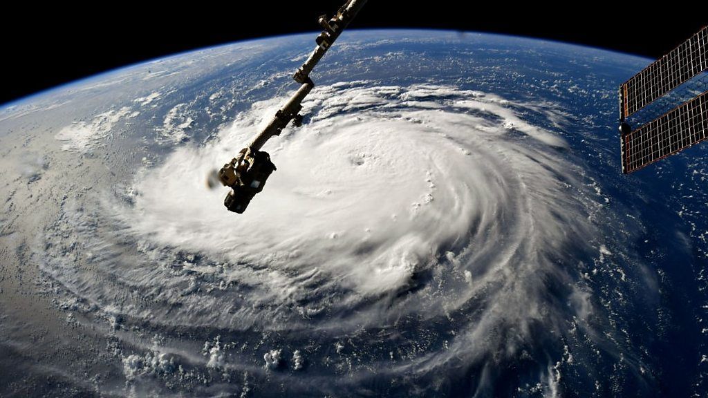
Hurricane Lee is expected to intensify into an "extremely dangerous" category four storm by the weekend, says the US National Hurricane Center (NHC).
The Atlantic storm became a category two hurricane, packing 105mph (168km/h) winds, on Thursday morning.
The NHC said it was too early to determine whether it might make landfall in the US.
But swells generated by the storm could reach the Virgin Islands and Puerto Rico by this weekend.
Lee is "forecast to become a major hurricane by early Friday... and remain a very strong hurricane through the weekend", the NHC said.
For now, meteorologists warned the Leeward Islands, where the Caribbean and Atlantic join, to be on the alert.

Winds from Lee are projected to reach 145mph (233km/h) later in the week, which would make it a category four hurricane.
"The question doesn't appear to be if RI (rapid intensification) continues, but rather how strong Lee will get, and how quickly will it get there," the NHC said.
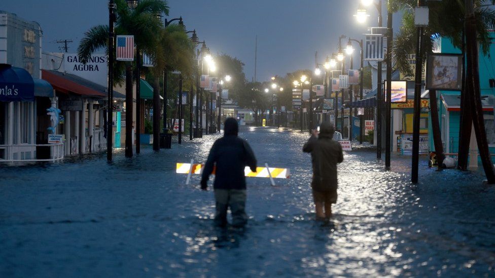
It comes just days after category three Hurricane Idalia made landfall in Florida, wreaking an estimated billions of dollars in damage, before sweeping over Georgia and the Carolinas. Major power outages lasted for days in Georgia.
Mid-September is considered to be the peak of the hurricane season, which ends on 30 November.
The 2023 Atlantic hurricane season is forecast to be more active than average.
The impact of climate change on the frequency of tropical storms is still unclear, but increased sea surface temperatures warm the air above and make more energy available to drive hurricanes.
As a result, they are likely to be more intense with more extreme rainfall.
Watch: Hurricane Idalia: 12 hours in 80 seconds
- Published30 August 2023
- Published29 August 2023
- Published28 August 2023