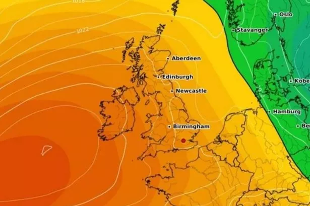
Brits are set to enjoy a two-week stretch of "hot and dry" weather as a "high pressure" system brings sunshine across the nation, as April is expected to conclude on a warm note. The Met Office has forecasted "a good deal of dry weather for many areas," with settled conditions likely to extend northwards.
The north west of the UK is anticipated to experience the most heat, with the driest conditions predicted in that region for the period from April 28 to May 12. The forecast also suggests: "If any more unsettled conditions develop these are more likely to affect south with a risk of some heavy rain or showers. Temperatures will probably be close to average overall, with warm days but some colder nights."
In addition, the Met Office's outlook from April 18 to April 27 indicates that a "build of pressure" is expected, which could mean drier weather for the UK "as a whole". The BBC weather team has noted that the drier trend might persist from April 22 onwards, reports the Mirror.
Read more:
- M32 underpass becomes ‘impassable’ as people 'can't access their home' amid flooding
- Beloved pet killed during dog attack that left two people injured
They said: "The final week of the month remains uncertain, but there are some indications that the high pressure just west of or over the UK will hold, potentially leading to calmer and drier weather particularly in the north and west."
As we step into May, forecasters have hinted at a potential change in pace: "There is a chance that conditions will calm down overall and temperatures will gradually rise, depending on the exact positioning of the high-pressure area (over the UK or over Scandinavia)."
Bristol Live What's On WhatsApp

Join Bristol Live’s WhatsApp community for What's On news sent directly to your phone
Bristol Live is now on WhatsApp and we want you to join our community. Through the app, we’ll share the top stories about Bristol events, restaurants, family attractions, nightlife and much more straight to your phone, so you can stay updated with things to do and places to go.
To join our community you need to already have WhatsApp. All you need to do is click this link and select ‘Join Community’. No one will be able to see who is signed up and no one can send messages except the Bristol Live team.
We also treat community members to special offers, promotions and adverts from us and our partners. If you don’t like our community, you can check out at any time you like.
To leave our community, click on the name at the top of your screen and choose ‘Exit group’. If you’re curious, you can read our Privacy Notice.
After a pleasantly warm weekend, Monday saw the country hit once again by gales and bouts of heavy rainfall. The dismal conditions came with a Met Office wind warning, with 55mph gusts predicted across large parts of England, Wales and Northern Ireland.
The skies cleared into the afternoon however, and forecasters predict a drier day today (Tuesday, April 16). Bristol and the South West can expect some further strong winds, but the Met Office said these won't be nearly as powerful as Monday.
Met Office South West forecast
Today:
A drier day with plenty of sunny spells, though the odd shower still possible. Another breezy day though winds much lighter than on Monday. Feeling fresher than of late. Maximum temperature 12 °C.
Tonight:
Remaining dry for most overnight with some clear spells, although a few showers still possible. Winds easing and tuning chilly, with some patchy frost in prone rural spots. Minimum temperature 5 °C.
Wednesday:
A chilly but mostly dry and bright stay to the day. Turning cloudier later with showers and patchy rain at times. Breezy, and temperatures around average. Maximum temperature 12 °C.
Outlook for Thursday to Saturday:
Dry and chilly to start on Thursday, but outbreaks of rain spreading southeast overnight. Turning drier through Friday with sunny spells into the weekend, and temperatures around average.